Showing posts with label Pompano Beach. Show all posts

Friday, September 24, 2010

Report Card: MLK Blvd, Pompano Beach, Florida

Pompano Beach

Broward County, Florida

Dr. Martin Luther King Jr Boulevard

(formerly named: Hammondville Road and Third Street)

Zip Code: 33060

Overview:

MLK Blvd through Pompano Beach starts at Dixie Highway, which is the historical center of the city that divides east from west at the railway tracks. Heading west, it is a four-lane road with commercial zoning fronting the road. To the south is the commercial core of Pompano Beach, and immediately behind the commercial zoning to the north is a viable but hurting residential neighborhood. The locals, including the Black locals, still refer to this section of MLK Blvd as Third Street.

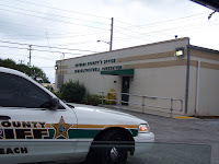
After about a mile one drives under the I-95 freeway (no entrance to freeway) and enters the industrial corridor. This section of MLK Blvd is still referred to by the locals as Hammondville Road. On both sides of the freeway the area has a hard-core inner-city feel to it and I would not be anywhere near here after dark. From here (the 1100 block) to the end, the area to the north is pure industrial, with the exception of the Sunshine Health Center at 1711 MLK Blvd. This is a health center that caters to Medicaid and Medicare recipients and also offers dentistry. The area to the south is residential, and a sheriff’s substation is located on the corner of 18th Avenue.
Once past Powerline Road (2100 block), you are in NIMBY land, where there are two strip joints and three prisons within blocks of MLK Blvd.

MLK Blvd ends at NW 31 Avenue, where there is a Florida Turnpike entrance.

Length:

Approximately 3 miles

·000 Block (Dixie Highway) to 3100 Block West.

Category:

Residential Neighborhood (houses fronting MLK Blvd) = 0%

Commercial Corridor: Main Street = 0%

Commercial Corridor: Mom & Pop Shops = 20%

·Blighted and Ignored = 30%

·Blighted but Not Ignored = 30%

·Gentrification Failing = 0%

·Gentrification Succeeding = 10%

·Viable with Room to Improve = 20%

·Vibrant and Car Friendly = 10%

· Vibrant and Pedestrian Friendly = 0%

Industrial Corridor = 80%

·Blighted and Ignored = 50%

·Blighted but Not Ignored = 30%

· Gentrification Failing = 0%

·Gentrification Succeeding = 10%

·Viable with Room to Improve = 10%

· Vibrant and Car Friendly = 0%

·Vibrant and Pedestrian Friendly = 0%

Community Assets:

1) The E. Pat Larkins Community Center at 520 MLK Blvd. It is a brand new facility built in a relatively safe area. It seemed well staffed with a broad variety of programs for all age groups. (http://www.mypompanobeach.org)

2)Churches: Along the length of the boulevard there were three significantly large and well maintained churches, and perhaps a half-dozen small “store-front” churches.

3)National Chain Grocery or Department Stores: None were encountered.

4) Brand Name Franchised Restaurants: At the far western end, where the ramp to the turnpike is located and you are within a block of Coconut Creek, there is a Wendy's Restaurant.

5)Other National Franchises: None, not even an auto parts franchise.

NIMBY Items Encountered:

1)Three prison facilities (within 3 blocks)

2)Two strip clubs

3)Two major rail corridors

4)Three major overpasses (only two with access)

Indexing for This Topic:

Thursday, September 16, 2010

MLK Pompano Beach: On the "wrong" side of the tracks.

A visible railway presence in this day and age almost always means that you are either in an industrial park or in the inner city. It also could be both.

MLK Blvd in Pompano Beach falls in the category of "both," and it doesn't just have one major rail corridor, but two.

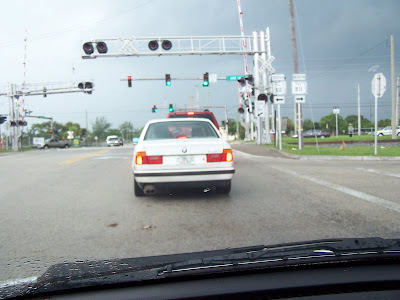
The easternmost tracks follow Dixie Highway, which also (coincidently?) marks the point where 3rd Street becomes MLK Blvd. This photo is taken while sitting on 3rd Street at the tracks, looking onto the beginning of MLK Blvd.

Behind me in this photo above is a fairly tidy neighborhood of single family and apartment homes. The volleyball court had a nice crowd of primarily white 20-somethings playing a game while their dogs watched from where they were tied to the chain link fence. I have good friends who live in a very upscale townhome just a few blocks away. In their minds, when I cross these tracks in front of me I will be on the "wrong side of the tracks."


View Larger Map

The above map shows Dr. Martin Luther King Blvd prominently, but a Mapquest map showed the road as Hammondville Road, which is a story for another blog post. The rail corridor in the above photo is out of sight to the right of the above map.

Next (below) is a photo of the other major rail corridor, which is on the west side of the I-95 freeway and runs along the Andrews Avenue industrial park (dead center in the map above). That is Andrews Avenue above us in this photo.While this is the Tri-Rail and Amtrak corridor, as well as a freight corridor, it does not mean that people who live here have good transit. There is a single bus (Route 60) that runs along MLK Blvd and it would take at least two connections to get to the Cypress Creek Tri-Rail Station. It is not too likely that anybody in this neighborhood will be taking Amtrak, so I won't concern you with how complicated it would be to get to the nearest Amtrak stop at Broward or Deerfield Beach.

Now, what you see out the window while riding in the Tri-Rail or Amtrak passenger cars from Northern Palm Beach County to the Miami Airport is the subject of an entirely different blog. Suffice it to say that a "white guy" riding on Tri-Rail fully understands what it means to be "in" the world, but not "of" the world. Most would focus on a book or the morning paper, diverting their eyes from a view that at times looks like a landscape from Calcutta.

Indexing for This Topic:

MLK Pompano Beach: Vacant Land

Vacant land in the inner city is not a good sign, and that is why I focus on it as part of my systematic review of an MLK Blvd.

In Pompano Beach, it is hard to tell what the vacant land is an indicator of, but here are just 12 of the pictures that I took on September 14, 2010. Trust me when I tell you that there were far more than just 12 vacant patches of land.

The photos are grouped in fours and you can click on a grouping to enlarge it. Also, if you see a building and think I made a mistake by including it as "vacant land," simply look behind or beside the building to see the vacant lot(s).

(More to read after the photos.)


More than anything else, vacant land represents to me the residual effects of "white flight," which is what gave rise to the pejorative use of the term "inner city" in the first place. Everybody who had the means fled to the suburbs to raise their children in a single-family detached home with a yard and a dog.

I will create a separate post as a reference for "white flight" later, but for now, if you have not read my post on "white privilege" and how it was perpetuated by "complicity," then take a moment to read up on that to better understand why an MLK Blvd would inherently have a lot of vacant lots along it.

For now, suffice it to say that apartment living and transit were originally NOT part of the plan for the suburbs. In other words, moving to the suburbs meant having a down payment for a house and a car. That is why the words "white flight" and not "country living" are more accurate.

Indexing for This Topic: